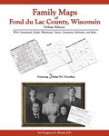
 Family Maps of
Fond du Lac County, Wisconsin: Deluxe Edition,
by Gregory A. Boyd, J.D. 8½x11”, spiral softbound book,
296 pages, with 71 total maps. There are 3 maps for each of the 22 Congressional
townships that make up Fond du Lac County. Each Township has a Patent Map,
Patent Index, Road Map, and a Map we call an Historical Map, which includes
Waterways, Watercourses & Railroads. The Road and Historical Maps also include
the City-centers and cemeteries that can be found at NationalAtlas.gov. There is
also a Surname/Patent Index and a Surname/Township Index to help you dive into
the right area of the County. Included Appendices identify multi-Patentee buying
groups and also list the numerous Aliquot (section) parts you might find.
ADAR294-$38.00
Family Maps of
Fond du Lac County, Wisconsin: Deluxe Edition,
by Gregory A. Boyd, J.D. 8½x11”, spiral softbound book,
296 pages, with 71 total maps. There are 3 maps for each of the 22 Congressional
townships that make up Fond du Lac County. Each Township has a Patent Map,
Patent Index, Road Map, and a Map we call an Historical Map, which includes
Waterways, Watercourses & Railroads. The Road and Historical Maps also include
the City-centers and cemeteries that can be found at NationalAtlas.gov. There is
also a Surname/Patent Index and a Surname/Township Index to help you dive into
the right area of the County. Included Appendices identify multi-Patentee buying
groups and also list the numerous Aliquot (section) parts you might find.
ADAR294-$38.00
 Family Maps of
Green
County, Wisconsin, Deluxe Edition,
by Gregory A. Boyd. 8½x11”,
spiral
softbound
book, 246 pages, with 53 total maps. There are 3 maps for
each of the 16 Congressional townships that make up
Green County. Each Township has a Patent
Map, Patent Index, Road Map, and a Map/Historical Map, which includes Waterways,
Watercourses & Railroads. The Road and Historical Maps also include the
City-centers and cemeteries that can be found at NationalAtlas.gov. There is
also a Surname/Patent Index and a Surname/Township Index to help you dive into
the right area of the County. Included Appendices identify multi-Patentee buying
groups and also list the numerous Aliquot (section) parts you might find.
ADAR295-$36.00
Family Maps of
Green
County, Wisconsin, Deluxe Edition,
by Gregory A. Boyd. 8½x11”,
spiral
softbound
book, 246 pages, with 53 total maps. There are 3 maps for
each of the 16 Congressional townships that make up
Green County. Each Township has a Patent
Map, Patent Index, Road Map, and a Map/Historical Map, which includes Waterways,
Watercourses & Railroads. The Road and Historical Maps also include the
City-centers and cemeteries that can be found at NationalAtlas.gov. There is
also a Surname/Patent Index and a Surname/Township Index to help you dive into
the right area of the County. Included Appendices identify multi-Patentee buying
groups and also list the numerous Aliquot (section) parts you might find.
ADAR295-$36.00
 Family Maps of
Iowa
County, Wisconsin, Deluxe Edition,
by Gregory A. Boyd. 8½x11”,
spiral
softbound
book, 370 pages, with 86 total maps. There are 3 maps for
each of the 27 Congressional townships that make up
Iowa County. Each Township has a Patent
Map, Patent Index, Road Map, and a Map/Historical Map, which includes Waterways,
Watercourses & Railroads. The Road and Historical Maps also include the
City-centers and cemeteries that can be found at NationalAtlas.gov. There is
also a Surname/Patent Index and a Surname/Township Index to help you dive into
the right area of the County. Included Appendices identify multi-Patentee buying
groups and also list the numerous Aliquot (section) parts you might find.
ADAR296-$43.00
Family Maps of
Iowa
County, Wisconsin, Deluxe Edition,
by Gregory A. Boyd. 8½x11”,
spiral
softbound
book, 370 pages, with 86 total maps. There are 3 maps for
each of the 27 Congressional townships that make up
Iowa County. Each Township has a Patent
Map, Patent Index, Road Map, and a Map/Historical Map, which includes Waterways,
Watercourses & Railroads. The Road and Historical Maps also include the
City-centers and cemeteries that can be found at NationalAtlas.gov. There is
also a Surname/Patent Index and a Surname/Township Index to help you dive into
the right area of the County. Included Appendices identify multi-Patentee buying
groups and also list the numerous Aliquot (section) parts you might find.
ADAR296-$43.00
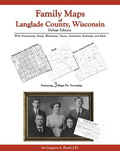 Family Maps of
Langlade County, Wisconsin, Deluxe Edition,
by Gregory A. Boyd. 8½x11”,
spiral
softbound
book, 300 pages, with 74 total maps. There are 3 maps for
each of the 23 Congressional townships that make up
Langlade County. Each Township has a
Patent Map, Patent Index, Road Map, and a Map/Historical Map, which includes
Waterways, Watercourses & Railroads. The Road and Historical Maps also include
the City-centers and cemeteries that can be found at NationalAtlas.gov. There is
also a Surname/Patent Index and a Surname/Township Index to help you dive into
the right area of the County. Included Appendices identify multi-Patentee buying
groups and also list the numerous Aliquot (section) parts you might find.
ADAR297-$39.00
Family Maps of
Langlade County, Wisconsin, Deluxe Edition,
by Gregory A. Boyd. 8½x11”,
spiral
softbound
book, 300 pages, with 74 total maps. There are 3 maps for
each of the 23 Congressional townships that make up
Langlade County. Each Township has a
Patent Map, Patent Index, Road Map, and a Map/Historical Map, which includes
Waterways, Watercourses & Railroads. The Road and Historical Maps also include
the City-centers and cemeteries that can be found at NationalAtlas.gov. There is
also a Surname/Patent Index and a Surname/Township Index to help you dive into
the right area of the County. Included Appendices identify multi-Patentee buying
groups and also list the numerous Aliquot (section) parts you might find.
ADAR297-$39.00
 Family Maps of
Lincoln
County, Wisconsin, Deluxe Edition, by Gregory A. Boyd. 8.5x11",
spiral
softbound
book. 380 pages, with 80 total maps. There are
3 maps for each of the 25 Congressional townships that make up Lincoln County.
Each Township has a Patent Map, Patent Index, Road Map, and a Map we call an
Historical Map: includes Watercourses,
Waterways, & Railroads. The Road and Historical Maps also include the
City-centers and cemeteries that can be found at NationalAtlas.gov. There is
also a Surname/Patent Index and a Surname/Township Index to help you dive into
the right area of the County. Included Appendices identify multi-Patentee buying
groups and also list the numerous Aliquot (section) you might find.
ADAR377-$43.00
Family Maps of
Lincoln
County, Wisconsin, Deluxe Edition, by Gregory A. Boyd. 8.5x11",
spiral
softbound
book. 380 pages, with 80 total maps. There are
3 maps for each of the 25 Congressional townships that make up Lincoln County.
Each Township has a Patent Map, Patent Index, Road Map, and a Map we call an
Historical Map: includes Watercourses,
Waterways, & Railroads. The Road and Historical Maps also include the
City-centers and cemeteries that can be found at NationalAtlas.gov. There is
also a Surname/Patent Index and a Surname/Township Index to help you dive into
the right area of the County. Included Appendices identify multi-Patentee buying
groups and also list the numerous Aliquot (section) you might find.
ADAR377-$43.00
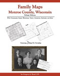 Family Maps of
Monroe County, Wisconsin, Deluxe Edition,
by Gregory A. Boyd. 8½x11”,
spiral
softbound book, 352 pages, with 83 total maps. There are 3
maps for each of the 26 Congressional townships that make up
Monroe County. Each Township has a Patent
Map, Patent Index, Road Map, and a Map/Historical Map, which includes Waterways,
Watercourses & Railroads. The Road and Historical Maps also include the
City-centers and cemeteries that can be found at NationalAtlas.gov. There is
also a Surname/Patent Index and a Surname/Township Index to help you dive into
the right area of the County. Included Appendices identify multi-Patentee buying
groups and also list the numerous Aliquot (section) parts you might find.
ADAR298-$43.00
Family Maps of
Monroe County, Wisconsin, Deluxe Edition,
by Gregory A. Boyd. 8½x11”,
spiral
softbound book, 352 pages, with 83 total maps. There are 3
maps for each of the 26 Congressional townships that make up
Monroe County. Each Township has a Patent
Map, Patent Index, Road Map, and a Map/Historical Map, which includes Waterways,
Watercourses & Railroads. The Road and Historical Maps also include the
City-centers and cemeteries that can be found at NationalAtlas.gov. There is
also a Surname/Patent Index and a Surname/Township Index to help you dive into
the right area of the County. Included Appendices identify multi-Patentee buying
groups and also list the numerous Aliquot (section) parts you might find.
ADAR298-$43.00
Return to top of page
|
Shopping Cart for WI Family Maps Section 2
S&H for up to 5 items will be added during PayPal checkout automatically.
Contact us if ordering more as S&H will alter.
|
Ordering Information
Print
& mail order form
|
Pre-order
form
or
Click
& print program - even more online items!


Current
Sale |
Book
Spotlight - changes periodically
Gift Services
All book sales final.
 Wholesale Information
Page Last Updated:
January 04, 2019
Gregath Website Home Page >
Online Catalog Home Page >
Book Catalog Table of Contents >
Wisconsin
State Books > Wisconsin Family Maps (Partial)