PO BOX 505, Wyandotte, OK 74370, USA
Phone 01-918-542-4148
Phone Hours: 9-3 CT/M-Th | Emails generally answered within one working day
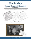 Family Maps of
Attala County, Mississippi, Deluxe Edition,
by Gregory A. Boyd, J.D. 8½x11”, softbound book, 322 pages. 80 maps, including 3
for each of the 25 Congressional Townships that make up
Attala County. Each Township has a Patent
Map, Patent Index, Road Map, and a Map/Historical Map, which includes Waterways,
Watercourses & Railroads. The Road and Historical Maps also include City-centers
and cemeteries that can be found at NationalAtlas.gov. There is also a separate
Surname/Patent Index and a Surname/Township Index to help you dive into the
right area of the County. ADAR234-$39.00
Family Maps of
Attala County, Mississippi, Deluxe Edition,
by Gregory A. Boyd, J.D. 8½x11”, softbound book, 322 pages. 80 maps, including 3
for each of the 25 Congressional Townships that make up
Attala County. Each Township has a Patent
Map, Patent Index, Road Map, and a Map/Historical Map, which includes Waterways,
Watercourses & Railroads. The Road and Historical Maps also include City-centers
and cemeteries that can be found at NationalAtlas.gov. There is also a separate
Surname/Patent Index and a Surname/Township Index to help you dive into the
right area of the County. ADAR234-$39.00
 Family
Maps of Benton County, Mississippi,
Deluxe Edition, by Gregory A. Boyd. 8.5x11",
softbound book,
176 pages with
59 total maps. Locating original
landowners in maps has never been an easy task-until now.
This volume in the Family Maps series contains newly created
maps of original landowners (patent maps) in what is now
Benton County, Mississippi, gleaned from the indexes of the
U.S. Bureau of Land Management. But it offers much more than
that. For each township in the county, there are two
additional maps accompanying the patent map: a road map and
a map showing waterways, railroads, and both modern and many
historical city-centers and cemeteries. Included are indexes
to help you locate what you are looking for, whether you
know a person's name, a last name, a place-name, or a
cemetery. The combination of maps and indexes are designed
to aid researchers of American history or genealogy to
explore frontier neighborhoods, examine family migrations,
locate hard-to-find cemeteries and towns, as well as locate
land based on legal descriptions found in old documents or
deeds. The patent-maps are essentially plat maps but instead
of depicting owners for a particular year, these maps show
original landowners, no matter when the transfer from the
federal government was completed. Dates of patents typically
begin near the time of statehood and run into the early
1900s. ADAR460-$33.00
Family
Maps of Benton County, Mississippi,
Deluxe Edition, by Gregory A. Boyd. 8.5x11",
softbound book,
176 pages with
59 total maps. Locating original
landowners in maps has never been an easy task-until now.
This volume in the Family Maps series contains newly created
maps of original landowners (patent maps) in what is now
Benton County, Mississippi, gleaned from the indexes of the
U.S. Bureau of Land Management. But it offers much more than
that. For each township in the county, there are two
additional maps accompanying the patent map: a road map and
a map showing waterways, railroads, and both modern and many
historical city-centers and cemeteries. Included are indexes
to help you locate what you are looking for, whether you
know a person's name, a last name, a place-name, or a
cemetery. The combination of maps and indexes are designed
to aid researchers of American history or genealogy to
explore frontier neighborhoods, examine family migrations,
locate hard-to-find cemeteries and towns, as well as locate
land based on legal descriptions found in old documents or
deeds. The patent-maps are essentially plat maps but instead
of depicting owners for a particular year, these maps show
original landowners, no matter when the transfer from the
federal government was completed. Dates of patents typically
begin near the time of statehood and run into the early
1900s. ADAR460-$33.00
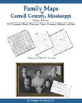 Family
Maps of Carroll County, Mississippi, Deluxe Edition, by Gregory A. Boyd.
8.5x11",
softbound book. 330 pages, with 89 total maps. There are 3 maps for
each of the 28 Congressional townships that make up Carroll County. Each
Township has a Patent Map, Patent Index, Road Map, and a Map we call an
Historical Map, which includes Waterways, Watercourses & Railroads. The Road and
Historical Maps also include the City-centers and cemeteries that can be found
at NationalAtlas.gov. There is also a Surname/Patent Index and a
Surname/Township Index to help you dive into the right area of the County.
Included Appendices identify multi-Patentee buying groups and also list the
numerous Aliquot (section) parts you might find. ADAR196-$39.00
Family
Maps of Carroll County, Mississippi, Deluxe Edition, by Gregory A. Boyd.
8.5x11",
softbound book. 330 pages, with 89 total maps. There are 3 maps for
each of the 28 Congressional townships that make up Carroll County. Each
Township has a Patent Map, Patent Index, Road Map, and a Map we call an
Historical Map, which includes Waterways, Watercourses & Railroads. The Road and
Historical Maps also include the City-centers and cemeteries that can be found
at NationalAtlas.gov. There is also a Surname/Patent Index and a
Surname/Township Index to help you dive into the right area of the County.
Included Appendices identify multi-Patentee buying groups and also list the
numerous Aliquot (section) parts you might find. ADAR196-$39.00
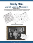
 Family Maps of
Copiah County, Mississippi, Deluxe Edition,
by Gregory A. Boyd. 8½x11”, softbound book, 356 pages, with 89 total maps. There
are 3 maps for each of the 28 Congressional townships that make up Copiah County. Each Township has a Patent
Map, Patent Index, Road Map, and a Map/Historical Map, which includes Waterways,
Watercourses & Railroads. The Road and Historical Maps also include the
City-centers and cemeteries that can be found at NationalAtlas.gov. There is
also a Surname/Patent Index and a Surname/Township Index to help you dive into
the right area of the County. Included Appendices identify multi-Patentee buying
groups and also list the numerous Aliquot (section) parts you might find.
ADAR235-$43.00
Family Maps of
Copiah County, Mississippi, Deluxe Edition,
by Gregory A. Boyd. 8½x11”, softbound book, 356 pages, with 89 total maps. There
are 3 maps for each of the 28 Congressional townships that make up Copiah County. Each Township has a Patent
Map, Patent Index, Road Map, and a Map/Historical Map, which includes Waterways,
Watercourses & Railroads. The Road and Historical Maps also include the
City-centers and cemeteries that can be found at NationalAtlas.gov. There is
also a Surname/Patent Index and a Surname/Township Index to help you dive into
the right area of the County. Included Appendices identify multi-Patentee buying
groups and also list the numerous Aliquot (section) parts you might find.
ADAR235-$43.00
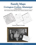 Family Maps of
Covington
County, Mississippi,
Deluxe Edition, By Gregory A. Boyd. 8½x11”,
softbound book, 202 pages, with 59 total maps. There are 3
maps for each of the 18 Congressional townships that make up Covington County.
Each Township has a Patent Map, Patent Index, Road Map, and a Map we call an
Historical Map, which includes Waterways, Watercourses & Railroads. The Road and
Historical Maps also include the City-centers and cemeteries that can be found
at NationalAtlas.gov. There is also a Surname/Patent Index and a
Surname/Township Index to help you dive into the right area of the County.
Included Appendices identify multi-Patentee buying groups and also list the
numerous Aliquot (section) parts you might find. ADAR315-$36.00
Family Maps of
Covington
County, Mississippi,
Deluxe Edition, By Gregory A. Boyd. 8½x11”,
softbound book, 202 pages, with 59 total maps. There are 3
maps for each of the 18 Congressional townships that make up Covington County.
Each Township has a Patent Map, Patent Index, Road Map, and a Map we call an
Historical Map, which includes Waterways, Watercourses & Railroads. The Road and
Historical Maps also include the City-centers and cemeteries that can be found
at NationalAtlas.gov. There is also a Surname/Patent Index and a
Surname/Township Index to help you dive into the right area of the County.
Included Appendices identify multi-Patentee buying groups and also list the
numerous Aliquot (section) parts you might find. ADAR315-$36.00
 Family Maps of
Forrest County, Mississippi, Deluxe Edition,
by Gregory A. Boyd. 8½x11”, softbound book, 188 pages, with 44 total maps. There
are 3 maps for each of the 13 Congressional townships that make up Forrest County. Each Township has a
Patent Map, Patent Index, Road Map, and a Map/Historical Map, which includes
Waterways, Watercourses & Railroads. The Road and Historical Maps also include
the City-centers and cemeteries that can be found at NationalAtlas.gov. There is
also a Surname/Patent Index and a Surname/Township Index to help you dive into
the right area of the County. Included Appendices identify multi-Patentee buying
groups and also list the numerous Aliquot (section) parts you might find.
ADAR236-$33.00
Family Maps of
Forrest County, Mississippi, Deluxe Edition,
by Gregory A. Boyd. 8½x11”, softbound book, 188 pages, with 44 total maps. There
are 3 maps for each of the 13 Congressional townships that make up Forrest County. Each Township has a
Patent Map, Patent Index, Road Map, and a Map/Historical Map, which includes
Waterways, Watercourses & Railroads. The Road and Historical Maps also include
the City-centers and cemeteries that can be found at NationalAtlas.gov. There is
also a Surname/Patent Index and a Surname/Township Index to help you dive into
the right area of the County. Included Appendices identify multi-Patentee buying
groups and also list the numerous Aliquot (section) parts you might find.
ADAR236-$33.00
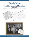 Family Maps of
Franklin County, Mississippi, Deluxe Edition,
by Gregory A. Boyd. 8½x11”, softbound book, 242 pages, with 65 total maps. There are 3 maps for
each of the 20 Congressional townships that make up Franklin County. Each Township has a
Patent Map, Patent Index, Road Map, and a Map/Historical Map, which includes
Waterways, Watercourses & Railroads. The Road and Historical Maps also include
the City-centers and cemeteries that can be found at NationalAtlas.gov. There is
also a Surname/Patent Index and a Surname/Township Index to help you dive into
the right area of the County. Included Appendices identify multi-Patentee buying
groups and also list the numerous Aliquot (section) parts you might find.
ADAR237-$36.00
Family Maps of
Franklin County, Mississippi, Deluxe Edition,
by Gregory A. Boyd. 8½x11”, softbound book, 242 pages, with 65 total maps. There are 3 maps for
each of the 20 Congressional townships that make up Franklin County. Each Township has a
Patent Map, Patent Index, Road Map, and a Map/Historical Map, which includes
Waterways, Watercourses & Railroads. The Road and Historical Maps also include
the City-centers and cemeteries that can be found at NationalAtlas.gov. There is
also a Surname/Patent Index and a Surname/Township Index to help you dive into
the right area of the County. Included Appendices identify multi-Patentee buying
groups and also list the numerous Aliquot (section) parts you might find.
ADAR237-$36.00
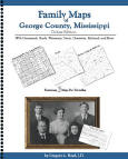 Family Maps of
George
County, Mississippi, Deluxe Edition, by Gregory A. Boyd. 8.5x11",
softbound book,
184 pages with
56 total maps. Locating original
landowners in maps has never been an easy task-until now.
This volume in the Family Maps series contains newly created
maps of original landowners (patent maps) in what is now
George County, Mississippi, gleaned from the indexes of
the U.S. Bureau of Land Management. But it offers much more
than that. For each township in the county, there are two
additional maps accompanying the patent map: a road map and
a map showing waterways, railroads, and both modern and many
historical city-centers and cemeteries. Included are indexes
to help you locate what you are looking for, whether you
know a person's name, a last name, a place-name, or a
cemetery. The combination of maps and indexes are designed
to aid researchers of American history or genealogy to
explore frontier neighborhoods, examine family migrations,
locate hard-to-find cemeteries and towns, as well as locate
land based on legal descriptions found in old documents or
deeds. The patent-maps are essentially plat maps but instead
of depicting owners for a particular year, these maps show
original landowners, no matter when the transfer from the
federal government was completed. Dates of patents typically
begin near the time of statehood and run into the early
1900s.
ADAR461-$33.00
Family Maps of
George
County, Mississippi, Deluxe Edition, by Gregory A. Boyd. 8.5x11",
softbound book,
184 pages with
56 total maps. Locating original
landowners in maps has never been an easy task-until now.
This volume in the Family Maps series contains newly created
maps of original landowners (patent maps) in what is now
George County, Mississippi, gleaned from the indexes of
the U.S. Bureau of Land Management. But it offers much more
than that. For each township in the county, there are two
additional maps accompanying the patent map: a road map and
a map showing waterways, railroads, and both modern and many
historical city-centers and cemeteries. Included are indexes
to help you locate what you are looking for, whether you
know a person's name, a last name, a place-name, or a
cemetery. The combination of maps and indexes are designed
to aid researchers of American history or genealogy to
explore frontier neighborhoods, examine family migrations,
locate hard-to-find cemeteries and towns, as well as locate
land based on legal descriptions found in old documents or
deeds. The patent-maps are essentially plat maps but instead
of depicting owners for a particular year, these maps show
original landowners, no matter when the transfer from the
federal government was completed. Dates of patents typically
begin near the time of statehood and run into the early
1900s.
ADAR461-$33.00
 Family Maps of
Grenada County, Mississippi, Deluxe Edition,
by Gregory A. Boyd. 8½x11”, softbound book, 218 pages, with 56 total maps. There are 3 maps for
each of the 17 Congressional townships that make up Grenada County. Each Township has a
Patent Map, Patent Index, Road Map, and a Map/Historical Map, which includes
Waterways, Watercourses & Railroads. The Road and Historical Maps also include
the City-centers and cemeteries that can be found at NationalAtlas.gov. There is
also a Surname/Patent Index and a Surname/Township Index to help you dive into
the right area of the County. Included Appendices identify multi-Patentee buying
groups and also list the numerous Aliquot (section) parts you might find.
ADAR238-$36.00
Family Maps of
Grenada County, Mississippi, Deluxe Edition,
by Gregory A. Boyd. 8½x11”, softbound book, 218 pages, with 56 total maps. There are 3 maps for
each of the 17 Congressional townships that make up Grenada County. Each Township has a
Patent Map, Patent Index, Road Map, and a Map/Historical Map, which includes
Waterways, Watercourses & Railroads. The Road and Historical Maps also include
the City-centers and cemeteries that can be found at NationalAtlas.gov. There is
also a Surname/Patent Index and a Surname/Township Index to help you dive into
the right area of the County. Included Appendices identify multi-Patentee buying
groups and also list the numerous Aliquot (section) parts you might find.
ADAR238-$36.00
 Family Maps of Hinds
County, Mississippi, Deluxe Edition, by Gregory A. Boyd, J.D. 8½x11”,
softbound book, 412
pages, with 98 total maps. There are 3 maps for each of the 31 Congressional
townships that make up Hinds
County. Each Township has a Patent Map, Patent Index, Road Map, and a
Map/Historical Map, which includes Waterways, Watercourses & Railroads. The Road
and Historical Maps also include the City-centers and cemeteries that can be
found at NationalAtlas.gov. There is also a Surname/Patent Index and a
Surname/Township Index to help you dive into the right area of the County.
Included Appendices identify multi-Patentee buying groups and also list the
numerous Aliquot (section) parts you might find.
ADAR239-$46.00
Family Maps of Hinds
County, Mississippi, Deluxe Edition, by Gregory A. Boyd, J.D. 8½x11”,
softbound book, 412
pages, with 98 total maps. There are 3 maps for each of the 31 Congressional
townships that make up Hinds
County. Each Township has a Patent Map, Patent Index, Road Map, and a
Map/Historical Map, which includes Waterways, Watercourses & Railroads. The Road
and Historical Maps also include the City-centers and cemeteries that can be
found at NationalAtlas.gov. There is also a Surname/Patent Index and a
Surname/Township Index to help you dive into the right area of the County.
Included Appendices identify multi-Patentee buying groups and also list the
numerous Aliquot (section) parts you might find.
ADAR239-$46.00
 Family Maps of
Holmes County, Mississippi, Deluxe Edition,
by Gregory A. Boyd, J.D. 8½x11”, softbound book, 300 pages, with 101 total maps.
There are 3 maps for each of the 32 Congressional townships that make up Holmes County. Each Township has a Patent
Map, Patent Index, Road Map, and a Map/Historical Map, which includes Waterways,
Watercourses & Railroads. The Road and Historical Maps also include the
City-centers and cemeteries that can be found at NationalAtlas.gov. There is
also a Surname/Patent Index and a Surname/Township Index to help you dive into
the right area of the County. Included Appendices identify multi-Patentee buying
groups and also list the numerous Aliquot (section) parts you might find.
ADAR240-$39.00
Family Maps of
Holmes County, Mississippi, Deluxe Edition,
by Gregory A. Boyd, J.D. 8½x11”, softbound book, 300 pages, with 101 total maps.
There are 3 maps for each of the 32 Congressional townships that make up Holmes County. Each Township has a Patent
Map, Patent Index, Road Map, and a Map/Historical Map, which includes Waterways,
Watercourses & Railroads. The Road and Historical Maps also include the
City-centers and cemeteries that can be found at NationalAtlas.gov. There is
also a Surname/Patent Index and a Surname/Township Index to help you dive into
the right area of the County. Included Appendices identify multi-Patentee buying
groups and also list the numerous Aliquot (section) parts you might find.
ADAR240-$39.00
 Family Maps of
Jasper County, Mississippi, Deluxe Edition,
by Gregory A. Boyd. 8½x11”, softbound book, 282 pages, with 68 total maps. There
are 3 maps for each of the 21 Congressional townships that make up
Jasper County. Each Township has a Patent
Map, Patent Index, Road Map, and a Map/Historical Map, which includes Waterways,
Watercourses & Railroads. The Road and Historical Maps also include the
City-centers and cemeteries that can be found at NationalAtlas.gov. There is
also a Surname/Patent Index and a Surname/Township Index to help you dive into
the right area of the County. Included Appendices identify multi-Patentee buying
groups and also list the numerous Aliquot (section) parts you might find.
ADAR241-$38.00
Family Maps of
Jasper County, Mississippi, Deluxe Edition,
by Gregory A. Boyd. 8½x11”, softbound book, 282 pages, with 68 total maps. There
are 3 maps for each of the 21 Congressional townships that make up
Jasper County. Each Township has a Patent
Map, Patent Index, Road Map, and a Map/Historical Map, which includes Waterways,
Watercourses & Railroads. The Road and Historical Maps also include the
City-centers and cemeteries that can be found at NationalAtlas.gov. There is
also a Surname/Patent Index and a Surname/Township Index to help you dive into
the right area of the County. Included Appendices identify multi-Patentee buying
groups and also list the numerous Aliquot (section) parts you might find.
ADAR241-$38.00
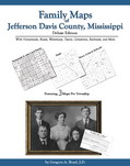 Family Maps of
Jefferson Davis County, Mississippi, Deluxe Edition,
by Gregory A. Boyd. 8½x11”, softbound book, 206 pages, with 56 total maps. There
are 3 maps for each of the 17 Congressional townships that make up
Jefferson Davis County. Each Township has
a Patent Map, Patent Index, Road Map, and a Map/Historical Map, which includes
Waterways, Watercourses & Railroads. The Road and Historical Maps also include
the City-centers and cemeteries that can be found at NationalAtlas.gov. There is
also a Surname/Patent Index and a Surname/Township Index to help you dive into
the right area of the County. Included Appendices identify multi-Patentee buying
groups and also list the numerous Aliquot (section) parts you might find.
ADAR242-$36.00
Family Maps of
Jefferson Davis County, Mississippi, Deluxe Edition,
by Gregory A. Boyd. 8½x11”, softbound book, 206 pages, with 56 total maps. There
are 3 maps for each of the 17 Congressional townships that make up
Jefferson Davis County. Each Township has
a Patent Map, Patent Index, Road Map, and a Map/Historical Map, which includes
Waterways, Watercourses & Railroads. The Road and Historical Maps also include
the City-centers and cemeteries that can be found at NationalAtlas.gov. There is
also a Surname/Patent Index and a Surname/Township Index to help you dive into
the right area of the County. Included Appendices identify multi-Patentee buying
groups and also list the numerous Aliquot (section) parts you might find.
ADAR242-$36.00
 Family Maps of
Jones
County, Mississippi, Deluxe Edition, by Gregory A. Boyd. 8.5x11",
softbound book,
276 pages with
80 total maps. Locating original
landowners in maps has never been an easy task-until now.
This volume in the Family Maps series contains newly created
maps of original landowners (patent maps) in what is now
Jones County, Mississippi, gleaned from the indexes of
the U.S. Bureau of Land Management. But it offers much more
than that. For each township in the county, there are two
additional maps accompanying the patent map: a road map and
a map showing waterways, railroads, and both modern and many
historical city-centers and cemeteries. Included are indexes
to help you locate what you are looking for, whether you
know a person's name, a last name, a place-name, or a
cemetery. The combination of maps and indexes are designed
to aid researchers of American history or genealogy to
explore frontier neighborhoods, examine family migrations,
locate hard-to-find cemeteries and towns, as well as locate
land based on legal descriptions found in old documents or
deeds. The patent-maps are essentially plat maps but instead
of depicting owners for a particular year, these maps show
original landowners, no matter when the transfer from the
federal government was completed. Dates of patents typically
begin near the time of statehood and run into the early
1900s.
ADAR462-$38.00
Family Maps of
Jones
County, Mississippi, Deluxe Edition, by Gregory A. Boyd. 8.5x11",
softbound book,
276 pages with
80 total maps. Locating original
landowners in maps has never been an easy task-until now.
This volume in the Family Maps series contains newly created
maps of original landowners (patent maps) in what is now
Jones County, Mississippi, gleaned from the indexes of
the U.S. Bureau of Land Management. But it offers much more
than that. For each township in the county, there are two
additional maps accompanying the patent map: a road map and
a map showing waterways, railroads, and both modern and many
historical city-centers and cemeteries. Included are indexes
to help you locate what you are looking for, whether you
know a person's name, a last name, a place-name, or a
cemetery. The combination of maps and indexes are designed
to aid researchers of American history or genealogy to
explore frontier neighborhoods, examine family migrations,
locate hard-to-find cemeteries and towns, as well as locate
land based on legal descriptions found in old documents or
deeds. The patent-maps are essentially plat maps but instead
of depicting owners for a particular year, these maps show
original landowners, no matter when the transfer from the
federal government was completed. Dates of patents typically
begin near the time of statehood and run into the early
1900s.
ADAR462-$38.00
 Family Maps of
Kemper County, Mississippi,
Deluxe Edition, by Gregory A.
Boyd. 8.5x11", softbound book. 314 pages, with
77 total maps. There are 3 maps for each of the 24 Congressional townships that
make up Kemper County. Each Township has a Patent Map, Patent Index, Road Map,
and a Map we call an Historical Map, which includes Waterways, Watercourses &
Railroads. The Road and Historical Maps also include the City-centers and
cemeteries that can be found at NationalAtlas.gov. There is also a
Surname/Patent Index and a Surname/Township Index to help you dive into the
right area of the County. Included Appendices identify multi-Patentee buying
groups and also list the numerous Aliquot (section) parts you might find.
ADAR368-$39.00
Family Maps of
Kemper County, Mississippi,
Deluxe Edition, by Gregory A.
Boyd. 8.5x11", softbound book. 314 pages, with
77 total maps. There are 3 maps for each of the 24 Congressional townships that
make up Kemper County. Each Township has a Patent Map, Patent Index, Road Map,
and a Map we call an Historical Map, which includes Waterways, Watercourses &
Railroads. The Road and Historical Maps also include the City-centers and
cemeteries that can be found at NationalAtlas.gov. There is also a
Surname/Patent Index and a Surname/Township Index to help you dive into the
right area of the County. Included Appendices identify multi-Patentee buying
groups and also list the numerous Aliquot (section) parts you might find.
ADAR368-$39.00
|
Shopping Cart for MS Family Maps #1 |
Ordering Information
Print
& mail order form
|
Pre-order
form
or
Click
& print program - even more online items!
![]()
![]()
Current Sale | Book Spotlight - changes periodically
All book sales final.
Gregath Website Home Page > Online Catalog > Book Catalog > State Books > Mississippi > Family Maps Books (partial)
Page Last Updated: January 09, 2019
Basic Gregath Search
powered by FreeFind
Gregath Company Website Table of Contents
Gregath Co., Inc.: Email Us |PO BOX 505, Wyandotte, OK 74370, USA | Phone 01-918-542-4148
All catalog sales final. Read about our shipping and handling charges for catalog orders.
We welcome suggestions and comments. Bookmark this page* for easy return.
Click Here to Bookmark This Site!
Copyright © Gregath Company, Incorporated
All rights reserved. All material on this site, including text, photographs, graphics, and code are protected by international copyright and trademark laws. Unauthorized use is not permitted. You may not modify, copy, reproduce, republish, upload, post, transmit or distribute, in any manner, the material on this website without prior permission.
Feel free to link to this page.