PO BOX 505, Wyandotte, OK 74370, USA
Phone 01-918-542-4148
Phone Hours: 9-3 CT/M-Th | Emails generally answered within one working day
 Family
Maps of Adams County, Illinois, Deluxe Edition,
by Gregory A. Boyd. 8½x11”, softbound book, 382 pages, with 86 total maps. There
are 3 maps for each of the 27 Congressional townships that make up
Adams County. Each Township has a Patent
Map, Patent Index, Road Map, and a Map/Historical Map, which includes Waterways,
Watercourses & Railroads. The Road and Historical Maps also include the
City-centers and cemeteries that can be found at NationalAtlas.gov. There is
also a Surname/Patent Index and a Surname/Township Index to help you dive into
the right area of the County. Included Appendices identify multi-Patentee buying
groups and also list the numerous Aliquot (section) parts you might find. The
Land-owners in this book are based upon records from the Illinois State
Archives, rather than the U.S. Bureau of Land Management (and that means MORE
people to be found).
ADAR79-$49.00
Family
Maps of Adams County, Illinois, Deluxe Edition,
by Gregory A. Boyd. 8½x11”, softbound book, 382 pages, with 86 total maps. There
are 3 maps for each of the 27 Congressional townships that make up
Adams County. Each Township has a Patent
Map, Patent Index, Road Map, and a Map/Historical Map, which includes Waterways,
Watercourses & Railroads. The Road and Historical Maps also include the
City-centers and cemeteries that can be found at NationalAtlas.gov. There is
also a Surname/Patent Index and a Surname/Township Index to help you dive into
the right area of the County. Included Appendices identify multi-Patentee buying
groups and also list the numerous Aliquot (section) parts you might find. The
Land-owners in this book are based upon records from the Illinois State
Archives, rather than the U.S. Bureau of Land Management (and that means MORE
people to be found).
ADAR79-$49.00
 Family
Maps of Bond County, Illinois, Deluxe Edition,
by Gregory A. Boyd. 8½x11”, softbound book, 216 pages, with 62 total maps. There
are 3 maps for each of the 19 Congressional townships that make up
Bond County. Each Township has a Patent
Map, Patent Index, Road Map, and a Map/Historical Map, which includes Waterways,
Watercourses & Railroads. The Road and Historical Maps also include the
City-centers and cemeteries that can be found at NationalAtlas.gov. There is
also a Surname/Patent Index and a Surname/Township Index to help you dive into
the right area of the County. Included Appendices identify multi-Patentee buying
groups and also list the numerous Aliquot (section) parts you might find. The
Land-owners in this book are based upon records from the Illinois State
Archives, rather than the U.S. Bureau of Land Management (and that means MORE
people to be found).
ADAR80-$41.00
Family
Maps of Bond County, Illinois, Deluxe Edition,
by Gregory A. Boyd. 8½x11”, softbound book, 216 pages, with 62 total maps. There
are 3 maps for each of the 19 Congressional townships that make up
Bond County. Each Township has a Patent
Map, Patent Index, Road Map, and a Map/Historical Map, which includes Waterways,
Watercourses & Railroads. The Road and Historical Maps also include the
City-centers and cemeteries that can be found at NationalAtlas.gov. There is
also a Surname/Patent Index and a Surname/Township Index to help you dive into
the right area of the County. Included Appendices identify multi-Patentee buying
groups and also list the numerous Aliquot (section) parts you might find. The
Land-owners in this book are based upon records from the Illinois State
Archives, rather than the U.S. Bureau of Land Management (and that means MORE
people to be found).
ADAR80-$41.00
 Family
Maps of Brown County, Illinois, Deluxe Edition, by Gregory A. Boyd, J.D. 8½x11”, softbound book, 156
pages. 38 maps, including 3 for each of the 11 Congressional Townships that make
up Brown County. Each Township has
a Patent Map, Patent Index, Road Map, and a Map/Historical Map, which includes
Waterways, Watercourses & Railroads. The Road and Historical Maps also include
City-centers and cemeteries that can be found at NationalAtlas.gov. There is
also a separate Surname/Patent Index and a Surname/Township Index to help you
dive into the right area of the County. ADAR81-$38.00
Family
Maps of Brown County, Illinois, Deluxe Edition, by Gregory A. Boyd, J.D. 8½x11”, softbound book, 156
pages. 38 maps, including 3 for each of the 11 Congressional Townships that make
up Brown County. Each Township has
a Patent Map, Patent Index, Road Map, and a Map/Historical Map, which includes
Waterways, Watercourses & Railroads. The Road and Historical Maps also include
City-centers and cemeteries that can be found at NationalAtlas.gov. There is
also a separate Surname/Patent Index and a Surname/Township Index to help you
dive into the right area of the County. ADAR81-$38.00
 Family
Maps of Cook County, Illinois, Deluxe Edition,
by Gregory A. Boyd. 8½x11”, softbound book, 506 pages, with 107 total maps.
There are 3 maps for each of the 34 Congressional townships that make up
Cook County. Each Township has a Patent
Map, Patent Index, Road Map, and a Map/Historical Map, which includes Waterways,
Watercourses & Railroads. The Road and Historical Maps also include the
City-centers and cemeteries that can be found at NationalAtlas.gov. There is
also a Surname/Patent Index and a Surname/Township Index to help you dive into
the right area of the County. Included Appendices identify multi-Patentee buying
groups and also list the numerous Aliquot (section) parts you might find. The
Land-owners in this book are based upon records from the Illinois State
Archives, rather than the U.S. Bureau of Land Management (and that means MORE
people to be found). The Land-owners in this book are based upon records from
the Illinois State Archives, rather than the U.S. Bureau of Land Management (and
that means MORE people to be found).
ADAR82-$55.00
Family
Maps of Cook County, Illinois, Deluxe Edition,
by Gregory A. Boyd. 8½x11”, softbound book, 506 pages, with 107 total maps.
There are 3 maps for each of the 34 Congressional townships that make up
Cook County. Each Township has a Patent
Map, Patent Index, Road Map, and a Map/Historical Map, which includes Waterways,
Watercourses & Railroads. The Road and Historical Maps also include the
City-centers and cemeteries that can be found at NationalAtlas.gov. There is
also a Surname/Patent Index and a Surname/Township Index to help you dive into
the right area of the County. Included Appendices identify multi-Patentee buying
groups and also list the numerous Aliquot (section) parts you might find. The
Land-owners in this book are based upon records from the Illinois State
Archives, rather than the U.S. Bureau of Land Management (and that means MORE
people to be found). The Land-owners in this book are based upon records from
the Illinois State Archives, rather than the U.S. Bureau of Land Management (and
that means MORE people to be found).
ADAR82-$55.00
 Family
Maps of Cumberland County, Illinois, Deluxe Edition,
by Gregory A. Boyd. 8½x11”, softbound book, 208 pages, with 50 total maps. There
are 3 maps for each of the 15 Congressional townships that make up
Cumberland County. Each Township has a
Patent Map, Patent Index, Road Map, and a Map/Historical Map, which includes
Waterways, Watercourses & Railroads. The Road and Historical Maps also include
the City-centers and cemeteries that can be found at NationalAtlas.gov. There is
also a Surname/Patent Index and a Surname/Township Index to help you dive into
the right area of the County. Included Appendices identify multi-Patentee buying
groups and also list the numerous Aliquot (section) parts you might find. The
Land-owners in this book are based upon records from the Illinois State
Archives, rather than the U.S. Bureau of Land Management (and that means MORE
people to be found).
ADAR83-$41.00
Family
Maps of Cumberland County, Illinois, Deluxe Edition,
by Gregory A. Boyd. 8½x11”, softbound book, 208 pages, with 50 total maps. There
are 3 maps for each of the 15 Congressional townships that make up
Cumberland County. Each Township has a
Patent Map, Patent Index, Road Map, and a Map/Historical Map, which includes
Waterways, Watercourses & Railroads. The Road and Historical Maps also include
the City-centers and cemeteries that can be found at NationalAtlas.gov. There is
also a Surname/Patent Index and a Surname/Township Index to help you dive into
the right area of the County. Included Appendices identify multi-Patentee buying
groups and also list the numerous Aliquot (section) parts you might find. The
Land-owners in this book are based upon records from the Illinois State
Archives, rather than the U.S. Bureau of Land Management (and that means MORE
people to be found).
ADAR83-$41.00
Family Maps of Jackson County,
Illinois, Deluxe Edition,
by Gregory A. Boyd. 8½x11”, softbound book, 314 pages, with 68 total maps. There
are 3 maps for each of the 21 Congressional townships that make up
Jackson County. Each Township has a
Patent Map, Patent Index, Road Map, and a Map/Historical Map, which includes
Waterways, Watercourses & Railroads. The Road and Historical Maps also include
the City-centers and cemeteries that can be found at NationalAtlas.gov. There is
also a Surname/Patent Index and a Surname/Township Index to help you dive into
the right area of the County. Included Appendices identify multi-Patentee buying
groups and also list the numerous Aliquot (section) parts you might find. The
Land-owners in this book are based upon records from the Illinois State
Archives, rather than the U.S. Bureau of Land Management (and that means MORE
people to be found).
ADAR92-$45.00
 Family Maps of Edwards County, Illinois, Deluxe Edition,
by Gregory A. Boyd. 8½x11”, softbound book, 174 pages, with 50 total maps. There
are 3 maps for each of the 15 Congressional townships that make up
Edwards County. Each Township has a
Patent Map, Patent Index, Road Map, and a Map/Historical Map, which includes
Waterways, Watercourses & Railroads. The Road and Historical Maps also include
the City-centers and cemeteries that can be found at NationalAtlas.gov. There is
also a Surname/Patent Index and a Surname/Township Index to help you dive into
the right area of the County. Included Appendices identify multi-Patentee buying
groups and also list the numerous Aliquot (section) parts you might find. The
Land-owners in this book are based upon records from the Illinois State
Archives, rather than the U.S. Bureau of Land Management (and that means MORE
people to be found).
ADAR85-$38.00
Family Maps of Edwards County, Illinois, Deluxe Edition,
by Gregory A. Boyd. 8½x11”, softbound book, 174 pages, with 50 total maps. There
are 3 maps for each of the 15 Congressional townships that make up
Edwards County. Each Township has a
Patent Map, Patent Index, Road Map, and a Map/Historical Map, which includes
Waterways, Watercourses & Railroads. The Road and Historical Maps also include
the City-centers and cemeteries that can be found at NationalAtlas.gov. There is
also a Surname/Patent Index and a Surname/Township Index to help you dive into
the right area of the County. Included Appendices identify multi-Patentee buying
groups and also list the numerous Aliquot (section) parts you might find. The
Land-owners in this book are based upon records from the Illinois State
Archives, rather than the U.S. Bureau of Land Management (and that means MORE
people to be found).
ADAR85-$38.00
 Family
Maps of Effingham County, Illinois, Deluxe Edition,
by Gregory A. Boyd. 8½x11”, softbound book, 258 pages, with 50 total maps. There
are 3 maps for each of the 15 Congressional townships that make up
Effingham County. Each Township has a
Patent Map, Patent Index, Road Map, and a Map/Historical Map, which includes
Waterways, Watercourses & Railroads. The Road and Historical Maps also include
the City-centers and cemeteries that can be found at NationalAtlas.gov. There is
also a Surname/Patent Index and a Surname/Township Index to help you dive into
the right area of the County. Included Appendices identify multi-Patentee buying
groups and also list the numerous Aliquot (section) parts you might find. The
Land-owners in this book are based upon records from the Illinois State
Archives, rather than the U.S. Bureau of Land Management (and that means MORE
people to be found).
ADAR86-$44.00
Family
Maps of Effingham County, Illinois, Deluxe Edition,
by Gregory A. Boyd. 8½x11”, softbound book, 258 pages, with 50 total maps. There
are 3 maps for each of the 15 Congressional townships that make up
Effingham County. Each Township has a
Patent Map, Patent Index, Road Map, and a Map/Historical Map, which includes
Waterways, Watercourses & Railroads. The Road and Historical Maps also include
the City-centers and cemeteries that can be found at NationalAtlas.gov. There is
also a Surname/Patent Index and a Surname/Township Index to help you dive into
the right area of the County. Included Appendices identify multi-Patentee buying
groups and also list the numerous Aliquot (section) parts you might find. The
Land-owners in this book are based upon records from the Illinois State
Archives, rather than the U.S. Bureau of Land Management (and that means MORE
people to be found).
ADAR86-$44.00 Family Maps of Fayette
County, Illinois, Deluxe Edition,
by Gregory A. Boyd. 8½x11”, softbound book, 368 pages, with 71 total maps. There
are 3 maps for each of the 22 Congressional townships that make up
Fayette County. Each Township has a
Patent Map, Patent Index, Road Map, and a Map/Historical Map, which includes
Waterways, Watercourses & Railroads. The Road and Historical Maps also include
the City-centers and cemeteries that can be found at NationalAtlas.gov. There is
also a Surname/Patent Index and a Surname/Township Index to help you dive into
the right area of the County. Included Appendices identify multi-Patentee buying
groups and also list the numerous Aliquot (section) parts you might find. The
Land-owners in this book are based upon records from the Illinois State
Archives, rather than the U.S. Bureau of Land Management (and that means MORE
people to be found).
ADAR87-$49.00
Family Maps of Fayette
County, Illinois, Deluxe Edition,
by Gregory A. Boyd. 8½x11”, softbound book, 368 pages, with 71 total maps. There
are 3 maps for each of the 22 Congressional townships that make up
Fayette County. Each Township has a
Patent Map, Patent Index, Road Map, and a Map/Historical Map, which includes
Waterways, Watercourses & Railroads. The Road and Historical Maps also include
the City-centers and cemeteries that can be found at NationalAtlas.gov. There is
also a Surname/Patent Index and a Surname/Township Index to help you dive into
the right area of the County. Included Appendices identify multi-Patentee buying
groups and also list the numerous Aliquot (section) parts you might find. The
Land-owners in this book are based upon records from the Illinois State
Archives, rather than the U.S. Bureau of Land Management (and that means MORE
people to be found).
ADAR87-$49.00
 Family
Maps of Franklin County, Illinois, Deluxe Edition, by Gregory A. Boyd, J.D. 8½x11”, softbound book, 169
pages. 44 Maps, including 3 for each of the 13 Congressional Townships that make
up Franklin County. Each Township
has a Patent Map, Patent Index, Road Map, and a Map/Historical Map, which
includes Waterways, Watercourses & Railroads. The Road and Historical Maps also
include City-centers and cemeteries that can be found at NationalAtlas.gov.
There is also a separate Surname/Patent Index and a Surname/Township Index to
help you dive into the right area of the County. ADAR88-$38.00
Family
Maps of Franklin County, Illinois, Deluxe Edition, by Gregory A. Boyd, J.D. 8½x11”, softbound book, 169
pages. 44 Maps, including 3 for each of the 13 Congressional Townships that make
up Franklin County. Each Township
has a Patent Map, Patent Index, Road Map, and a Map/Historical Map, which
includes Waterways, Watercourses & Railroads. The Road and Historical Maps also
include City-centers and cemeteries that can be found at NationalAtlas.gov.
There is also a separate Surname/Patent Index and a Surname/Township Index to
help you dive into the right area of the County. ADAR88-$38.00 Family
Maps of Greene County, Illinois, Deluxe Edition,
by Gregory A. Boyd. 8½x11”, softbound book, 286 pages, with 71 total maps. There
are 3 maps for each of the 22 Congressional townships that make up
Greene County. Each Township has a Patent
Map, Patent Index, Road Map, and a Map/Historical Map, which includes Waterways,
Watercourses & Railroads. The Road and Historical Maps also include the
City-centers and cemeteries that can be found at NationalAtlas.gov. There is
also a Surname/Patent Index and a Surname/Township Index to help you dive into
the right area of the County. Included Appendices identify multi-Patentee buying
groups and also list the numerous Aliquot (section) parts you might find.
ADAR89-$44.00
Family
Maps of Greene County, Illinois, Deluxe Edition,
by Gregory A. Boyd. 8½x11”, softbound book, 286 pages, with 71 total maps. There
are 3 maps for each of the 22 Congressional townships that make up
Greene County. Each Township has a Patent
Map, Patent Index, Road Map, and a Map/Historical Map, which includes Waterways,
Watercourses & Railroads. The Road and Historical Maps also include the
City-centers and cemeteries that can be found at NationalAtlas.gov. There is
also a Surname/Patent Index and a Surname/Township Index to help you dive into
the right area of the County. Included Appendices identify multi-Patentee buying
groups and also list the numerous Aliquot (section) parts you might find.
ADAR89-$44.00 Family
Maps of Grundy
County, Illinois, Deluxe Edition,
by Gregory A. Boyd. 8½x11”, softbound book, 188 pages, with 41 total maps. There
are 3 maps for each of the 12 Congressional townships that make up
Grundy County. Each Township has a Patent
Map, Patent Index, Road Map, and a Map/Historical Map, which includes Waterways,
Watercourses & Railroads. The Road and Historical Maps also include the
City-centers and cemeteries that can be found at NationalAtlas.gov. There is
also a Surname/Patent Index and a Surname/Township Index to help you dive into
the right area of the County. Included Appendices identify multi-Patentee buying
groups and also list the numerous Aliquot (section) parts you might find. The
Land-owners in this book are based upon records from the Illinois State
Archives, rather than the U.S. Bureau of Land Management (and that means MORE
people to be found).
ADAR90-$38.00
Family
Maps of Grundy
County, Illinois, Deluxe Edition,
by Gregory A. Boyd. 8½x11”, softbound book, 188 pages, with 41 total maps. There
are 3 maps for each of the 12 Congressional townships that make up
Grundy County. Each Township has a Patent
Map, Patent Index, Road Map, and a Map/Historical Map, which includes Waterways,
Watercourses & Railroads. The Road and Historical Maps also include the
City-centers and cemeteries that can be found at NationalAtlas.gov. There is
also a Surname/Patent Index and a Surname/Township Index to help you dive into
the right area of the County. Included Appendices identify multi-Patentee buying
groups and also list the numerous Aliquot (section) parts you might find. The
Land-owners in this book are based upon records from the Illinois State
Archives, rather than the U.S. Bureau of Land Management (and that means MORE
people to be found).
ADAR90-$38.00 Family
Maps of Hancock
County, Illinois, Deluxe Edition, by Gregory A. Boyd, J.D. 8½x11”, softbound book, 328
pages, with 83 total maps. There are 3 maps for each of the 26 Congressional
townships that make up Hancock
County. Each Township has a Patent Map, Patent Index, Road Map, and a
Map/Historical Map, which includes Waterways, Watercourses & Railroads. The Road
and Historical Maps also include the City-centers and cemeteries that can be
found at NationalAtlas.gov. There is also a Surname/Patent Index and a
Surname/Township Index to help you dive into the right area of the County.
Included Appendices identify multi-Patentee buying groups and also list the
numerous Aliquot (section) parts you might find.
ADAR91-$45.00
Family
Maps of Hancock
County, Illinois, Deluxe Edition, by Gregory A. Boyd, J.D. 8½x11”, softbound book, 328
pages, with 83 total maps. There are 3 maps for each of the 26 Congressional
townships that make up Hancock
County. Each Township has a Patent Map, Patent Index, Road Map, and a
Map/Historical Map, which includes Waterways, Watercourses & Railroads. The Road
and Historical Maps also include the City-centers and cemeteries that can be
found at NationalAtlas.gov. There is also a Surname/Patent Index and a
Surname/Township Index to help you dive into the right area of the County.
Included Appendices identify multi-Patentee buying groups and also list the
numerous Aliquot (section) parts you might find.
ADAR91-$45.00 Family
Maps of Kendall
County, Illinois, Deluxe Edition,
by Gregory A. Boyd. 8½x11”, softbound book, 142 pages, with 32 total maps. There
are 3 maps for each of the 9 Congressional townships that make up
Kendall County. Each Township has a
Patent Map, Patent Index, Road Map, and a Map/Historical Map, which includes
Waterways, Watercourses & Railroads. The Road and Historical Maps also include
the City-centers and cemeteries that can be found at NationalAtlas.gov. There is
also a Surname/Patent Index and a Surname/Township Index to help you dive into
the right area of the County. Included Appendices identify multi-Patentee buying
groups and also list the numerous Aliquot (section) parts you might find.
ADAR93-$33.00
Family
Maps of Kendall
County, Illinois, Deluxe Edition,
by Gregory A. Boyd. 8½x11”, softbound book, 142 pages, with 32 total maps. There
are 3 maps for each of the 9 Congressional townships that make up
Kendall County. Each Township has a
Patent Map, Patent Index, Road Map, and a Map/Historical Map, which includes
Waterways, Watercourses & Railroads. The Road and Historical Maps also include
the City-centers and cemeteries that can be found at NationalAtlas.gov. There is
also a Surname/Patent Index and a Surname/Township Index to help you dive into
the right area of the County. Included Appendices identify multi-Patentee buying
groups and also list the numerous Aliquot (section) parts you might find.
ADAR93-$33.00 Family
Maps of Knox
County, Illinois, Deluxe Edition, by Gregory A. Boyd, J.D. 8½x11”, softbound book, 273
pages, with 65 total maps. There are 3 maps for each of the 20 Congressional
townships that make up Knox
County. Each Township has a Patent Map, Patent Index, Road Map, and a
Map/Historical Map, which includes Waterways, Watercourses & Railroads. The Road
and Historical Maps also include the City-centers and cemeteries that can be
found at NationalAtlas.gov. There is also a Surname/Patent Index and a
Surname/Township Index to help you dive into the right area of the County.
Included Appendices identify multi-Patentee buying groups and also list the
numerous Aliquot (section) parts you might find.
ADAR94-$44.00
Family
Maps of Knox
County, Illinois, Deluxe Edition, by Gregory A. Boyd, J.D. 8½x11”, softbound book, 273
pages, with 65 total maps. There are 3 maps for each of the 20 Congressional
townships that make up Knox
County. Each Township has a Patent Map, Patent Index, Road Map, and a
Map/Historical Map, which includes Waterways, Watercourses & Railroads. The Road
and Historical Maps also include the City-centers and cemeteries that can be
found at NationalAtlas.gov. There is also a Surname/Patent Index and a
Surname/Township Index to help you dive into the right area of the County.
Included Appendices identify multi-Patentee buying groups and also list the
numerous Aliquot (section) parts you might find.
ADAR94-$44.00 Family
Maps of Macoupin County, Illinois, Deluxe Edition, by Gregory A. Boyd, J.D. 8½x11”, softbound book, 352
pages, with 77 total maps. There are 3 maps for each of the 24 Congressional
townships that make up Macoupin
County. Each Township has a Patent Map, Patent Index, Road Map, and a
Map/Historical Map, which includes Waterways, Watercourses & Railroads. The Road
and Historical Maps also include the City-centers and cemeteries that can be
found at NationalAtlas.gov. There is also a Surname/Patent Index and a
Surname/Township Index to help you dive into the right area of the County.
Included Appendices identify multi-Patentee buying groups and also list the
numerous Aliquot (section) parts you might find.
ADAR95-$49.00
Family
Maps of Macoupin County, Illinois, Deluxe Edition, by Gregory A. Boyd, J.D. 8½x11”, softbound book, 352
pages, with 77 total maps. There are 3 maps for each of the 24 Congressional
townships that make up Macoupin
County. Each Township has a Patent Map, Patent Index, Road Map, and a
Map/Historical Map, which includes Waterways, Watercourses & Railroads. The Road
and Historical Maps also include the City-centers and cemeteries that can be
found at NationalAtlas.gov. There is also a Surname/Patent Index and a
Surname/Township Index to help you dive into the right area of the County.
Included Appendices identify multi-Patentee buying groups and also list the
numerous Aliquot (section) parts you might find.
ADAR95-$49.00
 Family
Maps of Richland County, Illinois, Deluxe Edition,
by Gregory A. Boyd. 8½x11”, softbound book, 226 pages, with 59 total maps. There
are 3 maps for each of the 18 Congressional townships that make up
Richland County. Each Township has a
Patent Map, Patent Index, Road Map, and a Map/Historical Map, which includes
Waterways, Watercourses & Railroads. The Road and Historical Maps also include
the City-centers and cemeteries that can be found at NationalAtlas.gov. There is
also a Surname/Patent Index and a Surname/Township Index to help you dive into
the right area of the County. Included Appendices identify multi-Patentee buying
groups and also list the numerous Aliquot (section) parts you might find. The
Land-owners in this book are based upon records from the Illinois State
Archives, rather than the U.S. Bureau of Land Management (and that means MORE
people to be found).
ADAR96-$41.00
Family
Maps of Richland County, Illinois, Deluxe Edition,
by Gregory A. Boyd. 8½x11”, softbound book, 226 pages, with 59 total maps. There
are 3 maps for each of the 18 Congressional townships that make up
Richland County. Each Township has a
Patent Map, Patent Index, Road Map, and a Map/Historical Map, which includes
Waterways, Watercourses & Railroads. The Road and Historical Maps also include
the City-centers and cemeteries that can be found at NationalAtlas.gov. There is
also a Surname/Patent Index and a Surname/Township Index to help you dive into
the right area of the County. Included Appendices identify multi-Patentee buying
groups and also list the numerous Aliquot (section) parts you might find. The
Land-owners in this book are based upon records from the Illinois State
Archives, rather than the U.S. Bureau of Land Management (and that means MORE
people to be found).
ADAR96-$41.00
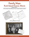 Family
Maps of Rock Island County, Illinois, Deluxe Edition,
by Gregory A. Boyd, J.D. 8½x11”, softbound book, 228 pages, with 77 total maps.
There are 3 maps for each of the 24 Congressional townships that make up
Rock Island County. Each Township has a
Patent Map, Patent Index, Road Map, and a Map/Historical Map, which includes
Waterways, Watercourses & Railroads. The Road and Historical Maps also include
the City-centers and cemeteries that can be found at NationalAtlas.gov. There is
also a Surname/Patent Index and a Surname/Township Index to help you dive into
the right area of the County. Included Appendices identify multi-Patentee buying
groups and also list the numerous Aliquot (section) parts you might find.
ADAR97-$41.00
Family
Maps of Rock Island County, Illinois, Deluxe Edition,
by Gregory A. Boyd, J.D. 8½x11”, softbound book, 228 pages, with 77 total maps.
There are 3 maps for each of the 24 Congressional townships that make up
Rock Island County. Each Township has a
Patent Map, Patent Index, Road Map, and a Map/Historical Map, which includes
Waterways, Watercourses & Railroads. The Road and Historical Maps also include
the City-centers and cemeteries that can be found at NationalAtlas.gov. There is
also a Surname/Patent Index and a Surname/Township Index to help you dive into
the right area of the County. Included Appendices identify multi-Patentee buying
groups and also list the numerous Aliquot (section) parts you might find.
ADAR97-$41.00
 Family Maps of Sangamon County, Illinois, Deluxe Edition,
by Gregory A. Boyd. 8½x11”, softbound book, 384 pages, with 113 total maps.
There are 3 maps for each of the 36 Congressional townships that make up
Sangamon County. Each Township has a
Patent Map, Patent Index, Road Map, and a Map/Historical Map, which includes
Waterways, Watercourses & Railroads. The Road and Historical Maps also include
the City-centers and cemeteries that can be found at NationalAtlas.gov. There is
also a Surname/Patent Index and a Surname/Township Index to help you dive into
the right area of the County. Included Appendices identify multi-Patentee buying
groups and also list the numerous Aliquot (section) parts you might find. The
Land-owners in this book are based upon records from the Illinois State
Archives, rather than the U.S. Bureau of Land Management (and that means MORE
people to be found).
ADAR98-$49.00
Family Maps of Sangamon County, Illinois, Deluxe Edition,
by Gregory A. Boyd. 8½x11”, softbound book, 384 pages, with 113 total maps.
There are 3 maps for each of the 36 Congressional townships that make up
Sangamon County. Each Township has a
Patent Map, Patent Index, Road Map, and a Map/Historical Map, which includes
Waterways, Watercourses & Railroads. The Road and Historical Maps also include
the City-centers and cemeteries that can be found at NationalAtlas.gov. There is
also a Surname/Patent Index and a Surname/Township Index to help you dive into
the right area of the County. Included Appendices identify multi-Patentee buying
groups and also list the numerous Aliquot (section) parts you might find. The
Land-owners in this book are based upon records from the Illinois State
Archives, rather than the U.S. Bureau of Land Management (and that means MORE
people to be found).
ADAR98-$49.00
 Family
Maps of Shelby County, Illinois, Deluxe Edition,
by Gregory A. Boyd. 8½x11”, softbound book, 386 pages, with 86 total maps. There
are 3 maps for each of the 27 Congressional townships that make up
Shelby County. Each Township has a Patent
Map, Patent Index, Road Map, and a Map/Historical Map, which includes Waterways,
Watercourses & Railroads. The Road and Historical Maps also include the
City-centers and cemeteries that can be found at NationalAtlas.gov. There is
also a Surname/Patent Index and a Surname/Township Index to help you dive into
the right area of the County. Included Appendices identify multi-Patentee buying
groups and also list the numerous Aliquot (section) parts you might find. The
Land-owners in this book are based upon records from the Illinois State
Archives, rather than the U.S. Bureau of Land Management (and that means MORE
people to be found).
ADAR99-$49.00
Family
Maps of Shelby County, Illinois, Deluxe Edition,
by Gregory A. Boyd. 8½x11”, softbound book, 386 pages, with 86 total maps. There
are 3 maps for each of the 27 Congressional townships that make up
Shelby County. Each Township has a Patent
Map, Patent Index, Road Map, and a Map/Historical Map, which includes Waterways,
Watercourses & Railroads. The Road and Historical Maps also include the
City-centers and cemeteries that can be found at NationalAtlas.gov. There is
also a Surname/Patent Index and a Surname/Township Index to help you dive into
the right area of the County. Included Appendices identify multi-Patentee buying
groups and also list the numerous Aliquot (section) parts you might find. The
Land-owners in this book are based upon records from the Illinois State
Archives, rather than the U.S. Bureau of Land Management (and that means MORE
people to be found).
ADAR99-$49.00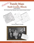 Family Maps of Stark County, Illinois, Deluxe Edition,
by Gregory A. Boyd. 8½x11”, softbound book, 134 pages, with 29 total maps. There
are 3 maps for each of the 8 Congressional townships that make up
Stark County. Each Township has a Patent
Map, Patent Index, Road Map, and a Map/Historical Map, which includes Waterways,
Watercourses & Railroads. The Road and Historical Maps also include the
City-centers and cemeteries that can be found at NationalAtlas.gov. There is
also a Surname/Patent Index and a Surname/Township Index to help you dive into
the right area of the County. Included Appendices identify multi-Patentee buying
groups and also list the numerous Aliquot (section) parts you might find. The
Land-owners in this book are based upon records from the Illinois State
Archives, rather than the U.S. Bureau of Land Management (and that means MORE
people to be found).
ADAR100-$33.00
Family Maps of Stark County, Illinois, Deluxe Edition,
by Gregory A. Boyd. 8½x11”, softbound book, 134 pages, with 29 total maps. There
are 3 maps for each of the 8 Congressional townships that make up
Stark County. Each Township has a Patent
Map, Patent Index, Road Map, and a Map/Historical Map, which includes Waterways,
Watercourses & Railroads. The Road and Historical Maps also include the
City-centers and cemeteries that can be found at NationalAtlas.gov. There is
also a Surname/Patent Index and a Surname/Township Index to help you dive into
the right area of the County. Included Appendices identify multi-Patentee buying
groups and also list the numerous Aliquot (section) parts you might find. The
Land-owners in this book are based upon records from the Illinois State
Archives, rather than the U.S. Bureau of Land Management (and that means MORE
people to be found).
ADAR100-$33.00
 Family
Maps of Union County, Illinois, Deluxe Edition, by Gregory A. Boyd, J.D. 8½x11”, softbound book, 177
pages. 47 maps, including 3 for each of the 14 Congressional Townships that make
up Union County. Each Township has
a Patent Map, Patent Index, Road Map, and a Map/Historical Map, which includes
Waterways, Watercourses & Railroads. The Road and Historical Maps also include
City-centers and cemeteries that can be found at NationalAtlas.gov. There is
also a separate Surname/Patent Index and a Surname/Township Index to help you
dive into the right area of the County. ADAR101-$38.00
Family
Maps of Union County, Illinois, Deluxe Edition, by Gregory A. Boyd, J.D. 8½x11”, softbound book, 177
pages. 47 maps, including 3 for each of the 14 Congressional Townships that make
up Union County. Each Township has
a Patent Map, Patent Index, Road Map, and a Map/Historical Map, which includes
Waterways, Watercourses & Railroads. The Road and Historical Maps also include
City-centers and cemeteries that can be found at NationalAtlas.gov. There is
also a separate Surname/Patent Index and a Surname/Township Index to help you
dive into the right area of the County. ADAR101-$38.00 Family Maps of Vermilion County, Illinois, Deluxe Edition,
by Gregory A. Boyd. 8½x11”, softbound book, 412 pages, with 107 total maps.
There are 3 maps for each of the 34 Congressional townships that make up
Vermilion County. Each Township has a
Patent Map, Patent Index, Road Map, and a Map/Historical Map, which includes
Waterways, Watercourses & Railroads. The Road and Historical Maps also include
the City-centers and cemeteries that can be found at NationalAtlas.gov. There is
also a Surname/Patent Index and a Surname/Township Index to help you dive into
the right area of the County. Included Appendices identify multi-Patentee buying
groups and also list the numerous Aliquot (section) parts you might find. The
Land-owners in this book are based upon records from the Illinois State
Archives, rather than the U.S. Bureau of Land Management (and that means MORE
people to be found).
ADAR102-$53.00
Family Maps of Vermilion County, Illinois, Deluxe Edition,
by Gregory A. Boyd. 8½x11”, softbound book, 412 pages, with 107 total maps.
There are 3 maps for each of the 34 Congressional townships that make up
Vermilion County. Each Township has a
Patent Map, Patent Index, Road Map, and a Map/Historical Map, which includes
Waterways, Watercourses & Railroads. The Road and Historical Maps also include
the City-centers and cemeteries that can be found at NationalAtlas.gov. There is
also a Surname/Patent Index and a Surname/Township Index to help you dive into
the right area of the County. Included Appendices identify multi-Patentee buying
groups and also list the numerous Aliquot (section) parts you might find. The
Land-owners in this book are based upon records from the Illinois State
Archives, rather than the U.S. Bureau of Land Management (and that means MORE
people to be found).
ADAR102-$53.00 Family Maps of White County, Illinois, Deluxe Edition, by Gregory A. Boyd, J.D. 8½x11”, softbound book, 238
pages, with 77 total maps. There are 3 maps for each of the 24 Congressional
townships that make up White
County. Each Township has a Patent Map, Patent Index, Road Map, and a
Map/Historical Map, which includes Waterways, Watercourses & Railroads. The Road
and Historical Maps also include the City-centers and cemeteries that can be
found at NationalAtlas.gov. There is also a Surname/Patent Index and a
Surname/Township Index to help you dive into the right area of the County.
Included Appendices identify multi-Patentee buying groups and also list the
numerous Aliquot (section) parts you might find.
ADAR103-$45.00
Family Maps of White County, Illinois, Deluxe Edition, by Gregory A. Boyd, J.D. 8½x11”, softbound book, 238
pages, with 77 total maps. There are 3 maps for each of the 24 Congressional
townships that make up White
County. Each Township has a Patent Map, Patent Index, Road Map, and a
Map/Historical Map, which includes Waterways, Watercourses & Railroads. The Road
and Historical Maps also include the City-centers and cemeteries that can be
found at NationalAtlas.gov. There is also a Surname/Patent Index and a
Surname/Township Index to help you dive into the right area of the County.
Included Appendices identify multi-Patentee buying groups and also list the
numerous Aliquot (section) parts you might find.
ADAR103-$45.00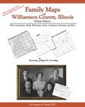 Family Maps of Williamson County, Illinois, Deluxe Edition,
by Gregory A. Boyd. 8½x11”, softbound book, 244 pages, with 41 total maps. There
are 3 maps for each of the 12 Congressional townships that make up
Williamson County. Each Township has a
Patent Map, Patent Index, Road Map, and a Map/Historical Map, which includes
Waterways, Watercourses & Railroads. The Road and Historical Maps also include
the City-centers and cemeteries that can be found at NationalAtlas.gov. There is
also a Surname/Patent Index and a Surname/Township Index to help you dive into
the right area of the County. Included Appendices identify multi-Patentee buying
groups and also list the numerous Aliquot (section) parts you might find. The
Land-owners in this book are based upon records from the Illinois State
Archives, rather than the U.S. Bureau of Land Management (and that means MORE
people to be found).
ADAR104-$41.00
Family Maps of Williamson County, Illinois, Deluxe Edition,
by Gregory A. Boyd. 8½x11”, softbound book, 244 pages, with 41 total maps. There
are 3 maps for each of the 12 Congressional townships that make up
Williamson County. Each Township has a
Patent Map, Patent Index, Road Map, and a Map/Historical Map, which includes
Waterways, Watercourses & Railroads. The Road and Historical Maps also include
the City-centers and cemeteries that can be found at NationalAtlas.gov. There is
also a Surname/Patent Index and a Surname/Township Index to help you dive into
the right area of the County. Included Appendices identify multi-Patentee buying
groups and also list the numerous Aliquot (section) parts you might find. The
Land-owners in this book are based upon records from the Illinois State
Archives, rather than the U.S. Bureau of Land Management (and that means MORE
people to be found).
ADAR104-$41.00 Family Maps of Winnebago County, Illinois, Deluxe Edition,
by Gregory A. Boyd. 8½x11”, softbound book, 264 pages, with 53 total maps. There
are 3 maps for each of the 16 Congressional townships that make up
Winnebago County. Each Township has a
Patent Map, Patent Index, Road Map, and a Map/Historical Map, which includes
Waterways, Watercourses & Railroads. The Road and Historical Maps also include
the City-centers and cemeteries that can be found at NationalAtlas.gov. There is
also a Surname/Patent Index and a Surname/Township Index to help you dive into
the right area of the County. Included Appendices identify multi-Patentee buying
groups and also list the numerous Aliquot (section) parts you might find. The
Land-owners in this book are based upon records from the Illinois State
Archives, rather than the U.S. Bureau of Land Management (and that means MORE
people to be found).
ADAR105-$44.00
Family Maps of Winnebago County, Illinois, Deluxe Edition,
by Gregory A. Boyd. 8½x11”, softbound book, 264 pages, with 53 total maps. There
are 3 maps for each of the 16 Congressional townships that make up
Winnebago County. Each Township has a
Patent Map, Patent Index, Road Map, and a Map/Historical Map, which includes
Waterways, Watercourses & Railroads. The Road and Historical Maps also include
the City-centers and cemeteries that can be found at NationalAtlas.gov. There is
also a Surname/Patent Index and a Surname/Township Index to help you dive into
the right area of the County. Included Appendices identify multi-Patentee buying
groups and also list the numerous Aliquot (section) parts you might find. The
Land-owners in this book are based upon records from the Illinois State
Archives, rather than the U.S. Bureau of Land Management (and that means MORE
people to be found).
ADAR105-$44.00
More Illinois History available on CD through GCI.
Print
and Mail Order Form
or
Click and print program - even more online items!


Current Sale | Book Spotlight - changes periodically
All book sales final.
Gregath Website Home Page > Online Catalog > Books > State > Illinois State Books
Page Last Updated: January 09, 2019

Basic Gregath Search
powered by FreeFind
Gregath Company Website Table of Contents
Gregath Co., Inc.: Email Us |PO BOX 505, Wyandotte, OK 74370, USA | Phone 01-918-542-4148
All catalog sales final. Read about our shipping and handling charges for catalog orders.
We welcome suggestions and comments. Bookmark this page* for easy return.
Click Here to Bookmark This Site!
Copyright © Gregath Company, Incorporated
All rights reserved. All material on this site, including text, photographs, graphics, and code are protected by international copyright and trademark laws. Unauthorized use is not permitted. You may not modify, copy, reproduce, republish, upload, post, transmit or distribute, in any manner, the material on this website without prior permission.
Feel free to link to this page.