Genealogy
in the Woods 2011
|
|||||
Retreat
|
Directions:
|
||||

|
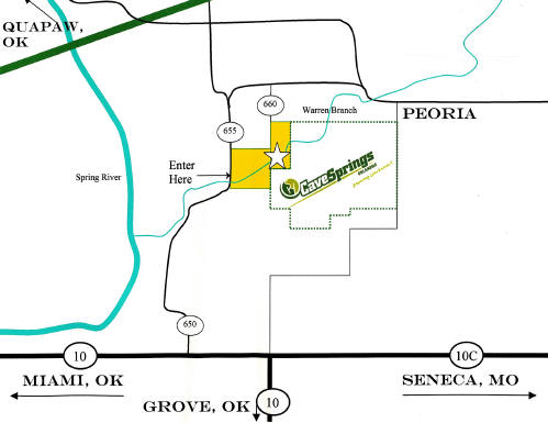
Proceed out of Miami east on
Highway 10 approximately 6 miles (beyond the construction zone, but
before Highway 10C junction) until you see the Sky Ranch at
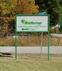
Cave Springs sign on the left (north) side of the highway (County
Road 650). Take County Road 650 approximately 4 miles.
It will take you over the creek and in view of the "swimmin
hole" and some campus facilities, shortly after the bridge, the
creek/main entrance gate is on the right (east)
- this is the entrance we
will use.
|
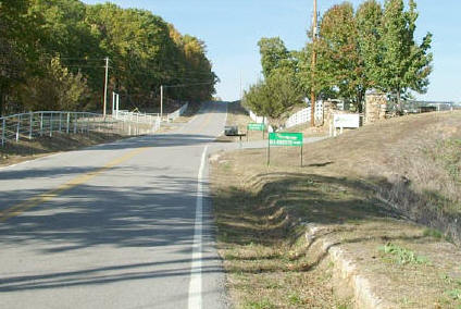
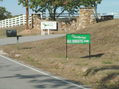
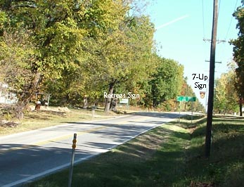
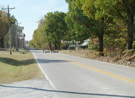
Think you still might have trouble spotting the Sky Ranch Sign off the highway? Due to tree growth, it can still be hard to see in the fall. Watch for the antique sign opposite (on the South side of the highway). In the past, there was a 7-Up sign (see photo above) as well. Now, go to the East or West approach picture and you'll see where it might be easier to spot for the first time than the camp sign. |
|
|
|
![]() From
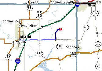
Joplin Airport (see above for maps and more photos):
From
Joplin Airport (see above for maps and more photos):
Turn right (west) out of the airport and proceed to first stoplight where you will turn left (south) onto Highway 43 (Joplin Main Street). Proceed through town and take I-44/Highway 43 (to Tulsa).
At this point you can either continue on to Miami, I-44 turns into the Will Rogers Turnpike, or follow the directions below:
Take the exit
4 (Highway 43 to Seneca). At the light at the top of the off ramp,
turn left (south) and proceed down Highway 43. Turn right (west)
at junction U - Highways 43 & 10C - proceeding west down Highway 10C.
Continue
 (past the 10C Junction, but before the Spring River bridge)
until you see the Sky Ranch at Cave Springs sign on the left (north) side of the highway
(County Road 650). (See above for more photographs).
(past the 10C Junction, but before the Spring River bridge)
until you see the Sky Ranch at Cave Springs sign on the left (north) side of the highway
(County Road 650). (See above for more photographs).
Early Warning - On Highway 10, approximately 1 mile from the turn (from either direction) there is now a Sky Ranch sign stating the turn off is in a mile.
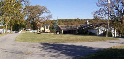
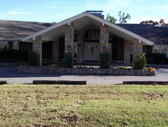
Take County Road 650 approximately 4 miles. It will take you over the creek and in view of the "swimmin hole" and some campus facilities, shortly after the bridge, the creek/main entrance gate is on the right (east) - this is the entrance we will use. Once this turn is made, follow the road through the campus gates, to the ranch house (second house) with concourse. For easy unload and parking, take the right branch and to pull down in front of the house. Unload and then follow pavement to the parking area.
![]()
Join Us!
![]()
Page Last Updated:
December 21, 2017